Little Bighorn was the only hard-and-fast planned stop for us on this trip out west. I won’t go into the history of what happened at Little Bighorn. If you don’t know what happened, you can read about it here and here and in a multitude of books. I suggest, even if you think you know what happened at Little Bighorn, read about it and then go there. I generally think the National Parks Service is the best thing the United States government has going for it, and the way the NPS handles Little Bighorn does not disappoint.
Before we started exploring the landscape, we sat in on one of the ranger talks they do there every couple of hours. The ranger we listened to is a good story teller and seemed knowledgeable and passionate about the subject. I recorded the entire 30 minute talk on my iPhone. Click here to view the video (or right-click on the link to download it to your desktop). You might need to download and install QuickTime for Windows if you’re having trouble viewing it.
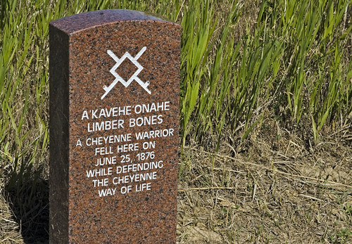
One of the uniquely engaging aspects of this battlefield is the stone markers placed on the ground near where individual soldiers and warriors fell. The photo below is of some of the markers on Last Stand Hill, where Lt. Col. Custer and his brother Tom were killed in action. Tom’s marker is directly in front of George’s.

About ten years ago, the National Parks Service began erecting granite markers for fallen Cheyenne and Lakota warriors as well. They chose red granite so it would stand out among the white stone markers erected for the troops of the 7th cavalry.
From the top of Last Stand Hill, looking north.

The sign reads:
The hill in front of you was occupied by Lakota and Cheyenne during the fight on Last Stand Hill. An unknown Sioux warrior wearing a warbonnet was killed here while firing his rifle at soldiers positioned behind a horse barricade on the crest of the ridge behind you. As soldier carbine fire ceased, victorious warriors rushed the hill.
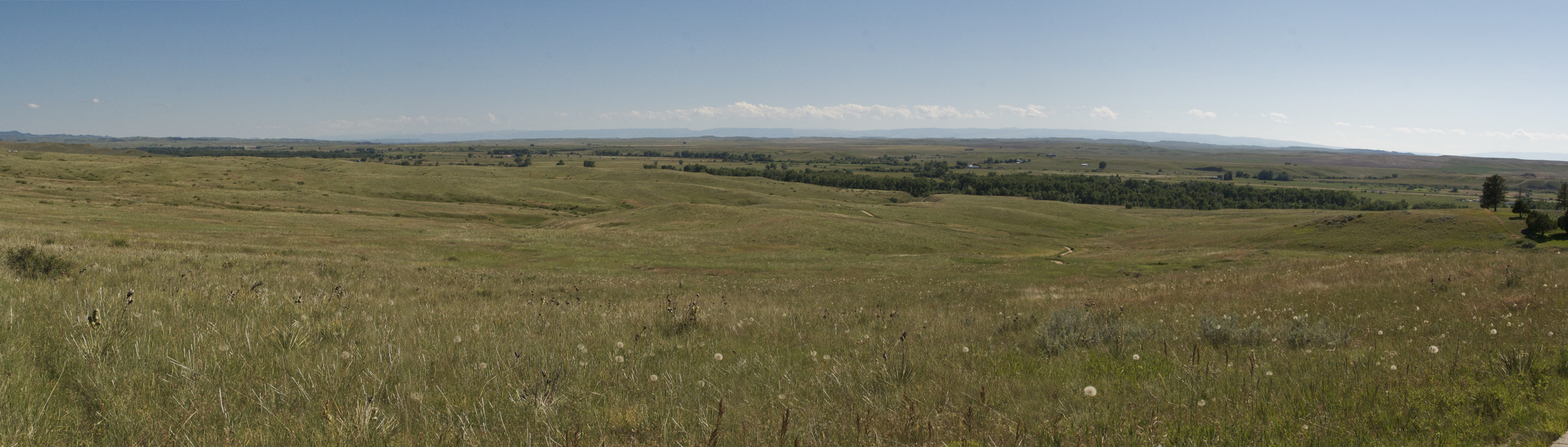
From the top of Last Stand Hill, looking south, towards the Little Bighorn and the Indian village.
About halfway down the path, looking back at Last Stand Hill (on the right), the visitor center (just left of center) and Custer National Cemetery (on the left).

Continuing to make our way down the path, towards the Little Bighorn.

The path ends at Deep Ravine, where the last shots were fired on this part of the battlefield. Historians don’t know exactly why the soldiers were running into the ravine. It may have been a tactical maneuver or an attempt at escape. The text on the sign is red, faded and very difficult to read.

